
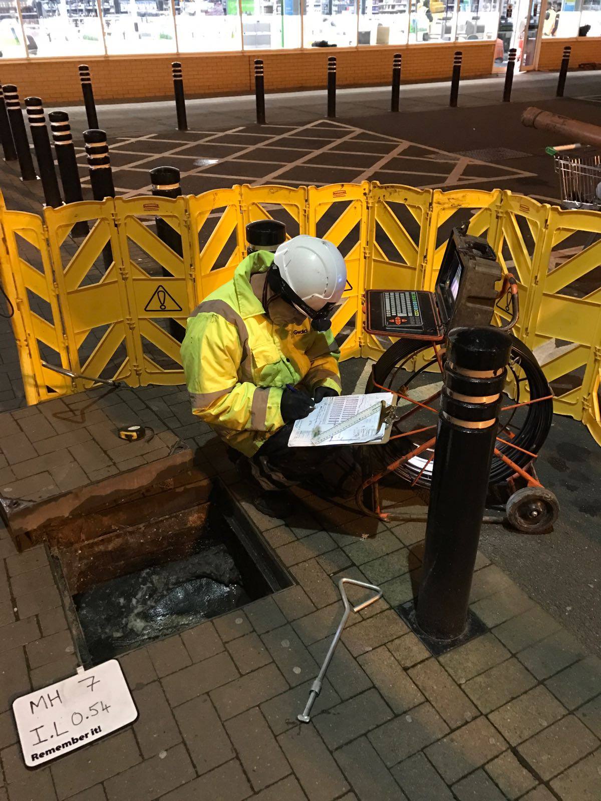
Before any construction, extension, or groundworks begin, having accurate knowledge of the drainage network beneath a property is essential. At Aqua Response, we provide precise drain mapping and locating services that identify the full layout, depth, condition, and connectivity of underground pipework.
Using advanced detection technology and CCTV inspection systems, our engineers create clear, detailed plans that support planning applications, construction design, compliance, and safe excavation. Whether you’re a developer, contractor, architect, or property owner, our mapping services ensure your project progresses efficiently and without costly surprises.
With accurate data, professional reporting, and years of industry expertise, Aqua Response helps you build with confidence, knowing exactly what lies below the surface.
When adding extensions, altering property layouts, or undertaking civil engineering works, having an accurate map of the drainage system is crucial. Our fully qualified engineers use the latest locating equipment and CCTV technology to identify:
Drain and sewer routes
Pipe depths and diameters
Locations of manholes and access points
Shared drainage connections
Any defects or structural issues
Flow direction and system layout
This critical data helps avoid costly mistakes during construction and ensures compliance with planning requirements and local authority standards.
Once tracing and mapping are complete, Aqua Response provides clear, detailed charts and plans, alongside optional CCTV drain inspection reports. These documents deliver everything required for planning submissions, structural design decisions, and on-site project management.
By identifying faults, weak points, or shared connections early, our drain charting significantly reduces the risk of disruption, delays, or expensive remedial works further into the project.
We use modern, industry-leading equipment to ensure accurate drain location and mapping, delivering dependable results for residential developments, commercial premises, industrial sites, and public infrastructure.
Our services support contractors, architects, surveyors, utilities providers, and property managers across the region.